Log in
All resources
Create a design
221 Free Artworks of Maps Of Rome
bibliothèque nationale de france
italia - di matteo greuter - btv1b53041991c
propaganda map
maps in the rijksmuseum amsterdam
neoclassicism
giovanni battista piranesi
engraving
national museum of maps and rare books, bucharest
trajan's column by pietro santi bartoli
works derived from tropaeum traiani
maps in the rijksmuseum amsterdam
18th-century maps of rome
san leonardo de albis
leonardo bufalini
1529 maps of iran
1529 maps
1529 maps of iran
1529 maps
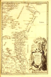
1529 maps of africa
1529 maps of iran
civitates orbis terrarum. urbium praecipuarum totius mundi. liber quartus
old maps of ancient rome (city)
collections of the national library of israel
1725 maps
16th-century maps of the middle east
propaganda map
1529 maps of iran
1529 maps
1529 maps of iran
1529 maps
1529 maps of iran
1529 maps
le antichità romane (piranesi)
neoclassicism
carta marina (lafreri)
antonio lafreri
prints by matteo greuter in the statens museum for kunst
copper
coat of arms of gregorius xiii (galleria delle carte geografiche)
reliefs of coats of arms in rome
ferrariae ducatus (galleria delle carte geografiche)
valli di comacchio
maps in the library of congress
propaganda map
prints by matteo greuter in the statens museum for kunst
copper
life of christ (barberini tapestries)
old maps of the holy land
speculum romanae magnificentiae (mirror of roman magnificence)
nicolas béatrizet
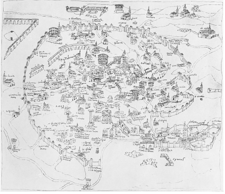
15th-century maps of rome
alessandro strozzi
propaganda map
1529 maps
propaganda map
1529 maps
prints by matteo greuter in the statens museum for kunst
copper
1642 maps
baroque
ancona (galleria delle carte geografiche)
giovanni battista rossi
1890s maps of yemen
ager puteolanus, siue, prospectus eiusdem insigniores (1620)
ancient roman villas in campania
maps in the rijksmuseum amsterdam
neoclassicism
description de l'universe
alain manesson mallet
description de l'universe
alain manesson mallet
civitas vetus (galleria delle carte geografiche)
russo-turkish war (1877–1878) in art
great eastern crisis (1875–78)
le antichità romane (piranesi)
neoclassicism
géographie générale; physique, politique et économique (1876)
1876 maps of italy
le antichità romane (piranesi)
neoclassicism
le antichità romane (piranesi)
neoclassicism
le antichità romane (piranesi)
neoclassicism
plans of santa maria del popolo (rome)
renaissance
beschreibung der städt der welt - braun & hogenberg - btv1b52512111k
maps of rome by braun & hogenberg
national museum of maps and rare books, bucharest
trajan's column by pietro santi bartoli
beschreibung der städt der welt - braun & hogenberg - btv1b52512111k
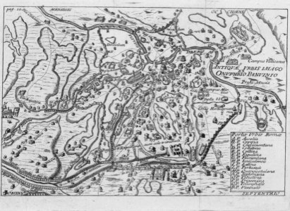
maps of ancient rome by braun & hogenberg
high renaissance
pirro ligorio
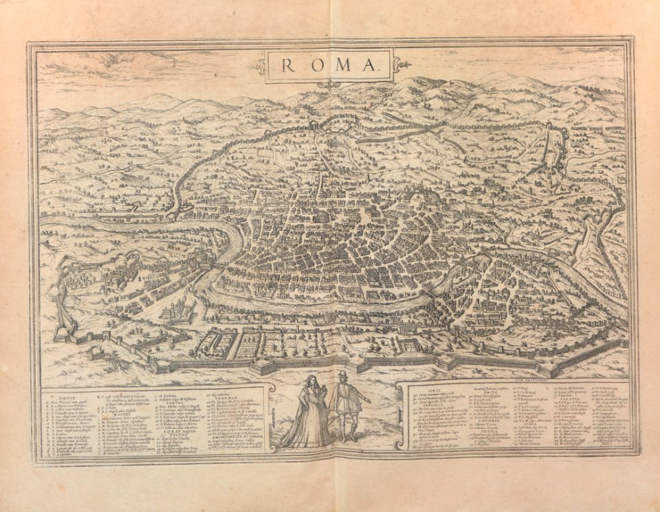
beschreibung und contrafactur der vornembster stät der welt, liber primus civitates orbis terrarum
maps of rome by braun & hogenberg
the topography of rome and its vicinity (1846)
tabula peutingeriana places in modern italy
the topography of rome and its vicinity (1846)
pratica di mare
national museum of maps and rare books, bucharest
trajan's column by pietro santi bartoli
life of christ (barberini tapestries)
tapestries of the flight into egypt
magazine fort, dublin
maps by john rocque
description de l'universe
alain manesson mallet
maps in the rijksmuseum amsterdam
the illustrated bartsch 61
maps in the rijksmuseum amsterdam
neoclassicism
beschreibung und contrafactur der vornembster stät der welt, liber primus civitates orbis terrarum
maps of rome by braun & hogenberg
history
maps
a pilgrimage to italy (1899)
19th-century maps of rome
old maps of ancient rome (city)
a pilgrimage to italy (1899)
seven pilgrim churches of rome
churches in rome in art
maps
city
maps
city
daniel de la feuille
1706 maps of italy
santa maria della pace (rome) - plans
baroque
maps of ancient rome by braun & hogenberg
high renaissance
military
maps
national museum of maps and rare books, bucharest
trajan's column by pietro santi bartoli
national museum of maps and rare books, bucharest
trajan's column by pietro santi bartoli
national museum of maps and rare books, bucharest
trajan's column by pietro santi bartoli
national museum of maps and rare books, bucharest
trajan's column by pietro santi bartoli
national museum of maps and rare books, bucharest
trajan's column by pietro santi bartoli
national museum of maps and rare books, bucharest
trajan's column by pietro santi bartoli
prints by matthäus greuter in the rijksmuseum amsterdam
maps in the rijksmuseum amsterdam
maps in the rijksmuseum amsterdam
18th-century maps of rome
templa diversa
mannerism
maps
sea
travel
book
civitates orbis terrarum. urbium praecipuarum totius mundi. liber quartus
16th-century maps showing history
travel
book
bibliothèque nationale de france
guillaume sanson
maps in the rijksmuseum amsterdam
neoclassicism
maps in the rijksmuseum amsterdam
neoclassicism
gabriel jacques de saint-aubin
battle of cape ecnomus
18th-century portrait paintings in the national maritime museum, london
john francis rigaud
templa diversa
mannerism
prints by matthäus greuter in the rijksmuseum amsterdam
etchings of gardens
maps in the rijksmuseum amsterdam
cornelis meijer
italia - di matteo greuter - btv1b53041991c
bibliothèque nationale de france
italia - di matteo greuter - btv1b53041991c
bibliothèque nationale de france
civitates orbis terrarum. de praecipuis totius universi urbibus. liber secundus
maps of ancient rome by braun & hogenberg
italia - di matteo greuter - btv1b53041991c
bibliothèque nationale de france
italia - di matteo greuter - btv1b53041991c
bibliothèque nationale de france
italia - di matteo greuter - btv1b53041991c
bibliothèque nationale de france
illustration
building
italia - di matteo greuter - btv1b53041991c
bibliothèque nationale de france
italia - di matteo greuter - btv1b53041991c
bibliothèque nationale de france
italia - di matteo greuter - btv1b53041991c
bibliothèque nationale de france
italia - di matteo greuter - btv1b53041991c
bibliothèque nationale de france
italia - di matteo greuter - btv1b53041991c
bibliothèque nationale de france
italia - di matteo greuter - btv1b53041991c
bibliothèque nationale de france
italia - di matteo greuter - btv1b53041991c
bibliothèque nationale de france
3 cartes gravées italiennes du xvième siècle représentant chypre sur la même feuille - btv1b530327226
bibliothèque nationale de france
3 cartes gravées italiennes du xvième siècle représentant chypre sur la même feuille - btv1b530327226
bibliothèque nationale de france
101 - 200 of 221
Next page
/ 3


![Beschreibung und Contrafactur der Vornembster stät der Welt, liber primus [Civities of the World], 1574](https://cdn.creazilla.com/illustrations/10000870357/beschreibung-und-contrafactur-der-vornembster-stt-der-welt-liber-primus-civities-of-the-world-1574-md.jpg)


![Beschreibung und Contrafactur der Vornembster stät der Welt, liber primus [Civities of the World], 1574](https://cdn.creazilla.com/illustrations/10000718446/beschreibung-und-contrafactur-der-vornembster-stt-der-welt-liber-primus-civities-of-the-world-1574-sm.webp)